
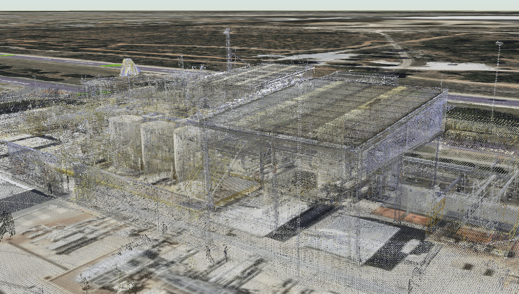
This is our engineering point cloud - a collection of data points defined by a given coordinate system representing the asset. They are made of high-density laser scanner using our reality-capture techniques that are unique to Airscope, producing quality work with an accuracy of 2.5mm across site.